The Warner Range and Surprise Valley
The Warner Range lies in the northeastern corner of California, near the Oregon and Nevada borders (see Google map to the right). Geologically, the Warner Range marks a border between two provinces with very different histories: the Basin and Range to the east and the Modoc Plateau to the west. Because of this unique geological setting, I am interested in learning more about the structure of the crust in this area and how that structure has changed through time. In order to do that, my colleagues and I have used the following techniques:
- Geologic field mapping
- Seismic experiments
- Geochronology and geochemical analysis of rocks
- Gravity and magnetic field mapping and modeling
Geologic field mapping

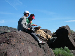
Students mapping in Surprise Valley.
Geologic maps are one of the basic datasets for understanding the geologic history of a region, and learning how to both create and interpret geologic maps is a fundamental component in the education of every geologist. In 2004, we began bringing students into the field to map the geology of the Warner Range - Surprise Valley region at a 1:24,000 scale, more detailed than previously existed for this area. The first step in beginning to map in a new region is to examine what work has already been done there, and to spend some time familiarizing yourself with the rocks. Most of the previous work in the Warner Range has been done on a smaller scale, so we hoped to define more units within the units already mapped by other workers. All of the rocks exposed in the Warner Range are younger that about 35 million years, and they are all sedimentary and volcanic rocks. The youngest volcanic rocks in the region are about 4 million years old. We worked to be able to distinguish units of different ages and depositional environments in order to both create a more detailed map and to determine the geologic history of the region.
Seismic experiments

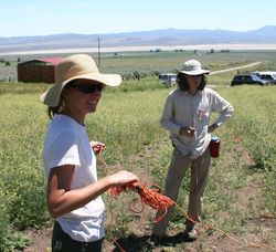
Laying out the trigger cable for a seismic experiment.
Geologists are able to infer a lot about what is going on below the surface by looking at the geology that is exposed. In the Warner Range region, we were able to map a large fault on the east side of the range. What if we want to find out how much motion has occurred along that fault? There are several ways to do so, but one way is to look at the subsurface. By sending sound waves down into the earth and measuring them when they return, we can get a "look" at the rocks below the surface.
Geochronology and geochemical analysis of rocks

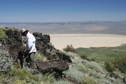
Drilling basalts in the Warner Range.
Analyzing the geochemistry of volcanic rocks can give us an indication of the possible source of the magma. Because the Warner Range is on the border between the Basin and Range and the Modoc Plateau, there are multiple possible sources:
- Subduction-related magmatism (like Mt. Shasta)
- Extension-related magmatism (like the rest of the Basin and Range)
- Hot spot- or plateau-related magmatism (like the Columbia Plateau basalts)